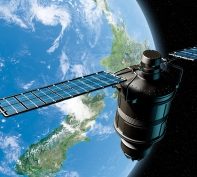
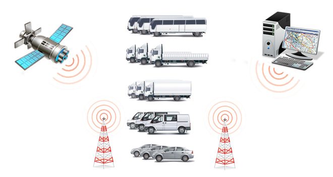
 One of the fast-growing GPS applications is vehicle tracking. GPS-equipped fleet vehicles, public transportation systems, delivery trucks, and courier services use receivers to monitor their locations at all times. Public safety services, police, fire, and emergency medical services, are using GPS receivers to determine the nearest service vehicle to an emergency, enabling the quickest response in critical situations.
Automatic Vehicle Location (AVL) is a technologically advanced method of remote vehicle tracking and monitoring using GPS. Each vehicle is equipped with a module that receives signals from a series of satellites, and calculates its current geographical location, speed, and heading. This information can be stored for later retrieval or, frequently, transmitted to a central dispatch/control location where it is displayed on a high-resolution geographical map.
Most users think of GPS as a means of determining position, but the constellation of 24 satellites is also an excellent timekeeper.

Automatic vehicle location (AVL) system GPS SPIDER, developed in Institute Mihailo Pupin combines GPS technology with wireless communications to deliver effective and affordable real-time vehicle tracking. GPS SPIDER keeps you informed on where your vehicle is and where it has been, how long it has been there, and the newre Spider-G system also displays information on fuel consumption as well as on other important information on your vehicles that can help you to quickly spot possible crisis or setbacks in fleet performance.
Our research activities include the application of GPS technology for vehicle location services. Various systems have been designed, developed and implemented, for different investors, including open pit mines, public transport, communal organizations, military applications, etc.
More information on GPS SPIDER ![]()
More information on GPS SPIDER G ![]()
GPS Real-Time Clock utilizes GPS satellite signals to determine exact time and date, providing the precision of an atomic clock for a fraction of the cost. It incorporates a combination of a GPS receiver and a high-quality, stable oscillator. GPS is used to discipline (calibrate) the oscillator to remove small biases in the frequency. The GPS Clock can synchronize both system timing and transceiver frequency, and is virtually fail-safe. It generates timing signals whenever there is power, and never needs to be re-calibrated.
IMP’s GPS Real-Time Clock provides following outputs, with 50 nanoseconds accuracy to UTC (Universal Time Coordinated):
- 1 pps (pulse per second)
- 1 ppm (pulse per minute)
- 1 pph (pulse per hour)
- Exact time and date values in ASCII format (suitable for distribution through RS232 and RS485 interfaces)
The signals generated on RS485 interfaces are galvanic isolated and allow for accuracy and perfect synchronization across several facilities that are a couple of kilometers apart.
GPS based timing already plays an important role in wireless networks and global data communications. Benefiters of GPS- based time synchronization are:
- Cellular companies and paging networks – to time the transfer of data and signals between cellular repeaters and paging towers
- Banks – to time-stamp transactions
- Electrical utilities – to troubleshoot power outages
Another wide area suitable for applications of GPS-based Clocks is computers, servers and Internet applications:
- Certified time stamping for financial and e-commerce transactions
- Enterprise networks
- Enhancement of network security and administration
- Billing for Internet service providers
- Network router and switch synchronization, etc.
